 Campsite Atlas
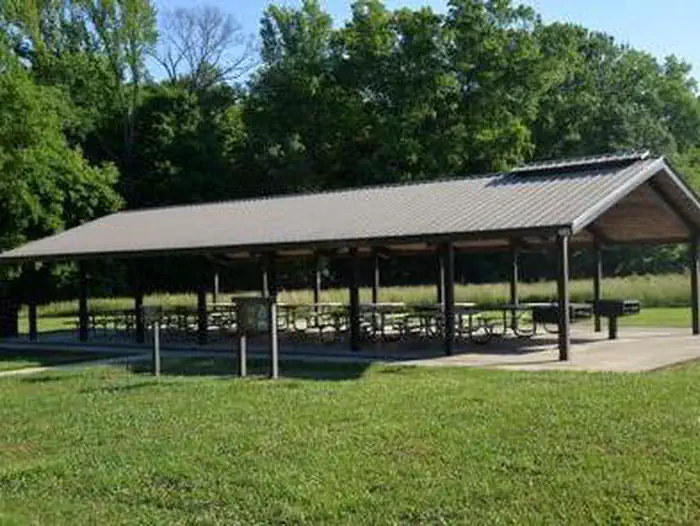
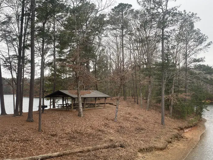
Rereg Dam Day Use Area Shelter
Reregulation Dam Day Use Area is actually two day use areas situated on the North and South Sides of the Coosawattee River. Both areas provide picnic sites, fishing piers and water access. The South Regulation Area encompasses an award winning nature trail that has an easy hike rating and can be enjoyed by all. The North Regulation Area contains a shelter that can be reserved. Fishing is a popular activity at the Reregulation Dam. Major species include bass (hybrid, striped and spotted) crappie, walleye, bream and catfish. The area provides picnic sites, restrooms, fishing piers, and water access. Shelter (CL-46) seating capacity is 100 people maximum and parking capacity of 50 vehicles.
Campsites
| group shelter nonelectric | 1 |
| Total | 1 |
Amenities & rules
Compiled from site-level records; individual sites vary. Confirm on Recreation.gov or with the managing office.
Getting there
From Atlanta: Take Interstate 75 North until Exit 293, turn right onto Georgia Highway 411 North, travel approximately 30 miles; take a right onto Georgia Highway 136 East; proceed across railroad tracks; turn left onto Old Highway 411 North, continue approximately 3/4 mile; turn right into Reregulation Dam Day Use Area.
Campgrounds nearby
Data source: Recreation.gov RIDB, retrieved August 30, 2026. The Campsite Atlas is an independent publication and is not affiliated with or endorsed by the Recreation.gov or any federal agency. Always confirm critical details on the official Recreation.gov page before you travel.