 Campsite Atlas
Valley Of Fires Recreation Area
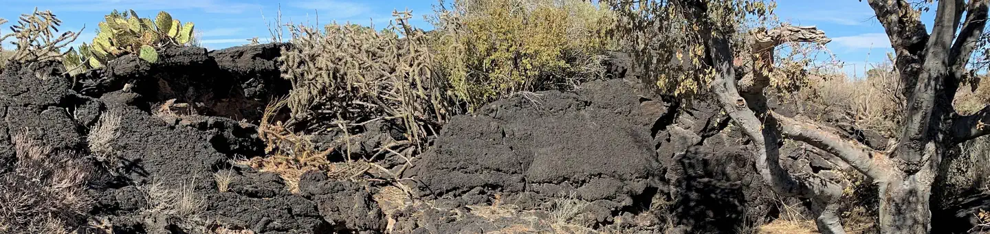
Valley of Fires recreation area is located immediately adjacent to the Malpais Lava Flow. Approximately 5,000 years ago, Little Black Peak erupted and flowed 44 miles into the Tularosa Basin, filling the basin with molten rock. The resulting lava flow is four to six miles wide, 160 feet thick and covers 125 square miles. The lava flow is considered to be one of the youngest lava flows in the continental United States. The Bureau of Land Management maintains and manages the Valley of Fires Recreation area, which is located four miles west of Carrizozo, NM, on US Highway 380. Valley of Fires offers both camping and day use.
Campsites
| RV with electric | 13 |
| Tent-only | 7 |
| RV, no hookups | 6 |
| group shelter electric | 1 |
| Total | 27 |
Amenities & rules
Compiled from site-level records; individual sites vary. Confirm on Recreation.gov or with the managing office.
Getting there
Travel four miles west of the town of Carrizozo on U.S. Highway 380. Valley of Fires recreation area is on the left.
Campgrounds nearby
 Reservable
26.3 miles away
 Reservable
45.5 miles away
 Reservable
50.3 miles away
 Reservable
50.6 miles away
Data source: Recreation.gov RIDB, retrieved August 30, 2026. The Campsite Atlas is an independent publication and is not affiliated with or endorsed by the Recreation.gov or any federal agency. Always confirm critical details on the official Recreation.gov page before you travel.