Rio Grande
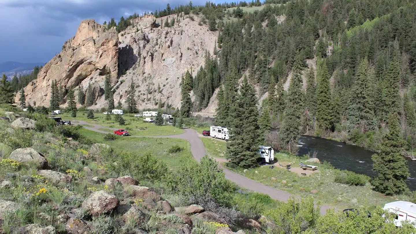
Rio Grande Campground This is a small, developed camping area in a grassy meadow, right on the banks of the Rio Grande. The campground has 7 camp sites with picnic tables and fire rings. Three sites are gravel pull-throughs and four sites are dead-end gravel spurs. The campground offers fishing access to the Rio Grande River and is a put in / take out point for summer rafting. Even though the grounds sit next to State highway 149, there is little highway noise as the campsites sits down below the road next to the river bottom. The river is very near the campground and is a safety hazard to children if unsupervised.
More like this: reservable in Colorado · tent only in Colorado
Check availability on Recreation.gov ↗

Site mix
| Standard, no hookups | 7 |
Amenities & rules
| Equipment | Tents |
| Fees | Single site - $10/night. Day use - $10/day (picnicking). Fee envelopes and a collection box located near the entrance. |
Individual sites vary. Confirm on Recreation.gov or with the managing office.
Season & status
| Status | Open |
| Season | Year round- Weather dependent |
| Forest | Rio Grande National Forest |
| Booking | First come, first serve. |
| Fees | Single site - $10/night. Day use - $10/day (picnicking). Fee envelopes and a collection box located near the entrance. |
| Rules | Must have a Colorado Fishing License to fish in the river. Area not recommended for large RVs or long/wide trailers due to narrow and steep access road. |
Weather by month
Getting there
From Creede, CO go 8.5 miles west on CO Highway 149 (toward Lake City). Turn left onto FSR 529 and continue for ~0.5 miles to campground.
| Nearest town | Del Norte, Colorado |
| Coordinates | 37.7626° N, 107.0114° W · Directions ↗ |
Good to know
- It is not recommended for large RVs or long/wide trailers because the access road going down into the site is narrow and steep.
Fire nearby
- WildfireElk
31 mi from the campground · 7,257 acres · 90% contained
- WildfireGold Mountain
42 mi from the campground · 39,747 acres · 92% contained
- PrescribedHigh Mesa Piles Rx
42 mi from the campground · 324 acres
Distance is to the reported incident point, not the fire edge. Call the managing office before you drive.
Supplies & services
| Dump station | Dump station ↗ | 24.7 mi |
| RV sales & service | RV sales & service ↗ | 25.2 mi |
| Outdoor gear | Ouray Mountain Sports ↗ | 40.3 mi |
Locations © OpenStreetMap contributors. Call ahead; hours change seasonally.
Explore
Worth a stop
- 5.2 miFern Creek Trailhead # 815 ↗Trailhead
- 5.6 miIvy Creek Trailhead # 805 ↗Trailhead
- 6.8 miLove Lake Picnic Site ↗Day use
- 7.7 mi
- 9.4 miRoad Canyon Boat Ramp ↗Boat launch
Trails nearby
- 4.9 miShallow Creek2.3 mi trail · hiking, horse, bike
Trail and trailhead records are the Forest Service's. Distances are straight-line to the nearer trail end. Trail conditions are not tracked here.
Public land it sits in
This campground sits inside Rio Grande National Forest.
- inRio Grande National Forest ↗National Forest · Forest Service · 1,937,280 acres
- 3.6 miWeminuche Wilderness ↗Wilderness · Forest Service · 497,111 acres
- 7.3 miSan Juan National Forest ↗National Forest · Forest Service · 2,094,539 acres
Each unit is published as a centre point and an acreage rather than a boundary, so this section stands it in for a circle of the same area. Whether a campground is inside, and how far it is from one it is outside, are both approximate.
Other campgrounds nearby


Cabin and lookout rentals nearby
On the National Register nearby
- Sevenmile BridgeStructure · Creede · 2.6 mi
- Zang’s Hotel and AnnexBuilding · Creede · 7.8 mi
- Wagon Wheel Gap Railroad StationBuilding · Creede · 10.1 mi
Guidebooks for Colorado
We earn a small commission if you buy through these links. It does not change what we list.
Titles come from Open Library's catalog, matched by subject heading or by title.
Reference
Questions people ask
Do I need a reservation at Rio Grande?
Sites at Rio Grande are reservable on Recreation.gov. First come, first serve. Any walk-up sites are listed on the booking page.
Source: Recreation.gov
How much does it cost to camp at Rio Grande?
Single site - $10/night. Day use - $10/day (picnicking). Fee envelopes and a collection box located near the entrance.
Source: Recreation.gov
Is Rio Grande open right now?
Open as of Oct 26, 2026. Season Year round- Weather dependent.
Source: Forest Service status
How many sites does Rio Grande have?
7 sites, including 7 standard sites without power.
Source: Recreation.gov
Can I bring an RV to Rio Grande?
Rio Grande is listed for tents only.
Source: Recreation.gov
What is the nearest town to Rio Grande?
Del Norte, Colorado.
Source: Getting there
What if Rio Grande is full?
The nearest public campgrounds are Marshall Park (2.3 mi), Ivy Creek (5.6 mi), and Bristol Head Campground (8.3 mi, first-come).
Source: Campgrounds nearby