 Campsite Atlas
Mt. Baldy-Buckhorn Ridge
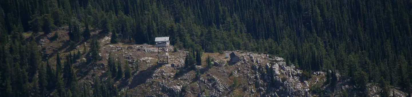
The Mount Baldy - Buckhorn Ridge Lookout sits at an elevation of 6,529 feet in the Kootenai National Forest. This location has been used as an observation point for detecting forest fires since 1910. The current lookout tower was built in 1957. The lookout is typically available from late June through late September, and is accessible by car, though high clearance vehicles are recommended for the primitive roads. Some creature comforts are provided, but guests should be prepared to pack in many of their own amenities. Aside from exploring Mount Baldy, hikers can find a network of trails in the surrounding Yaak Area.

Campsites
| Cabins | 1 |
| Total | 1 |
Amenities & rules
Compiled from site-level records; individual sites vary. Confirm on Recreation.gov or with the managing office.
Getting there
From Troy Montana, follow Highway 2 West for 9.5 miles to Yaak Highway 508. Follow Yaak Highway 508 for 18 miles north to Meadow Creek Road 524. Follow Road 524 1 mile to junction with Road 745. Take road 745 approximately 4 miles to Baldy Mountain Lookout Road 591. Follow 591 for approximately 2 miles to Road 5954. Take Road 5954 to the lookout.
Campgrounds nearby
5.2 miles away
5.2 miles away
Data source: Recreation.gov RIDB, retrieved August 30, 2026. The Campsite Atlas is an independent publication and is not affiliated with or endorsed by the Recreation.gov or any federal agency. Always confirm critical details on the official Recreation.gov page before you travel.