Pine Hills Campground
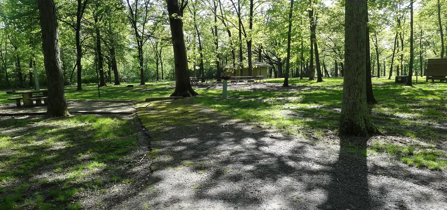
Pine Hills campground has level campsites with open grassy areas between campsites. Popular with hunters in the spring and fall, the campground is also ideal for those who like to view nature, go birding, hike or take a scenic drive. Pine Hills Road leads to the top of the bluffs and features panoramic views of the LaRue Swamp and Mississippi River floodplain. Located adjacent to one of the largest natural areas in the state Pine Hills is ideal for nature lovers. In addition the Snake Road, located at the bottom of the bluffs is closed biannually to vehicular traffic, to protect the thousands of the reptiles and amphibians as they migrate between their summer and winter habitats.
More like this: first-come in Illinois · tent only in Illinois

Amenities & rules
| Equipment | Tents |
| Fees | Campsites $10/night - 8 people & 2 vehicles max. Payment cash or check only. |
Individual sites vary. Confirm on Recreation.gov or with the managing office.
Season & status
| Status | Open |
| Season | Year-round |
| Forest | Shawnee National Forest |
| Booking | No reservations. |
| Fees | Campsites $10/night - 8 people & 2 vehicles max. Payment cash or check only. |
| Rules | Camp only at designated campsites. Camping is not allowed in LaRue Pine Hills Research Natural Area. Pets are allowed only on a leash. Stay on the designated trail. Pack it in, Pack it out, along trails. Collections of any kind is strictly prohibited within the Research Natural Area. Violators will be prosecuted. Refer to the Illinois Dept. |
Weather by month
Getting there
| Coordinates | 37.5156° N, 89.4222° W · Directions ↗ |
Supplies & services
| Dump station | Dump station ↗ | 15.3 mi |
| Outdoor gear | Shawnee Trail Outfitters ↗ | 18.1 mi |
| RV sales & service | WK Machine ↗ | 28.7 mi |
Locations © OpenStreetMap contributors. Call ahead; hours change seasonally.
Explore
Trails nearby
- under 0.1 miWhite Pine2.9 mi trail · hiking, horse
- 2.9 miRanbarger Hollow3.8 mi trail · hiking, horse
- 3.3 miCrooked Tree0.2 mi trail · hiking
- 3.4 miHutchins Creek2.3 mi trail · hiking, horse
- 4.2 miBridgeman1.3 mi trail · hiking, horse
- 4.2 miBald Knob West1.5 mi trail · hiking, horse
Trail and trailhead records are the Forest Service's. Distances are straight-line to the nearer trail end. Trail conditions are not tracked here.
Public land it sits in
Bald Knob Wilderness begins about 2.1 miles away, and it is the closest of these.
- 2.1 miBald Knob Wilderness ↗Wilderness · Forest Service · 5,800 acres
- 3.1 miClear Springs Wilderness ↗Wilderness · Forest Service · 4,739 acres
- 9.4 miShawnee National Forest ↗National Forest · Forest Service · 930,027 acres
Each unit is published as a centre point and an acreage rather than a boundary, so this section stands it in for a circle of the same area. Whether a campground is inside, and how far it is from one it is outside, are both approximate.
Other campgrounds nearby



On the National Register nearby
- Union LookoutStructure · Jonesboro · 4.3 mi
- Bainbridge FerrySite · Cape Girardeau · 7.2 mi
- Grand Tower Mining, Manufacturing and Transportation Company SiteSite · Grand Tower · 9.5 mi
Guidebooks for Shawnee National Forest and Illinois
We earn a small commission if you buy through these links. It does not change what we list.
Titles come from Open Library's catalog, matched by subject heading or by title.
Reference
Questions people ask
Do I need a reservation at Pine Hills Campground?
No. Pine Hills Campground is first-come, first-served. No reservations. Sites are taken on arrival and paid at the fee station.
Source: Forest Service
How much does it cost to camp at Pine Hills Campground?
Campsites $10/night - 8 people & 2 vehicles max. Payment cash or check only.
Source: Forest Service
Is Pine Hills Campground open right now?
Open as of Oct 26, 2026. Season Year-round.
Source: Forest Service status
Can I bring an RV to Pine Hills Campground?
Pine Hills Campground is listed for tents only.
Source: Forest Service
What if Pine Hills Campground is full?
The nearest public campgrounds are South Sandusky Campground (42.4 mi), Shagbark Group Area (42.9 mi), and South Marcum Campground (44.4 mi).
Source: Campgrounds nearby