Cherry Hill Campground
Developed campground with 26 designated sites. Each campsite has a picnic table, metal fire ring, and parking for at least one vehicle. Some sites can accommodate two vehicles. Located near historic Jonesville California, Cherry Hill is a popular spot for beating the valley heat. The campground is situated along Butte Creek amongst the pines with a main drive-in area as well as walk-in sites across the creek. Campers can enjoy fishing or relaxing along Butte Creek, exploring local roads and trails, hunting, and many other activities. A fee of $14/night is required at this site, fee must be paid upon arrival at the campground and before each night of camping.
More like this: first-come in California · tent only in California

Amenities & rules
| Equipment | Tents |
| Fees | $14 per site per night. Pass holders receive a 50% discount on the camping fee, see information board to find out which passes are accepted at this location. |
Individual sites vary. Confirm on Recreation.gov or with the managing office.
Season & status
| Status | Closed for the season. Forest Service sites close for the season; check the official page for the reopening date. |
| Season | Mid-May to September |
| Forest | Lassen National Forest |
| Booking | This campground is non-reservable. Saving campsites is prohibited. |
| Fees | $14 per site per night. Pass holders receive a 50% discount on the camping fee, see information board to find out which passes are accepted at this location. |
| Rules | Fee must be paid upon arrival and prior to each night of camping, Fee regulations are strictly enforced. Quiet hours are 10pm to 6am. Campfires allowed only in provided fire rings. 2 vehicles (including RVs/Boats/Etc.) and 8 persons allowed in each campsite. Pets must remain on a leash or confined at all times. |
Weather by month
Getting there
| Coordinates | 40.1028° N, 121.4972° W · Directions ↗ |
Fire nearby
- PrescribedPnf North Quincy Wcsl Rx
31 mi from the campground
- PrescribedPnf Rx
32 mi from the campground
- PrescribedLoafer Creek Dwr Vmp Rx
40 mi from the campground · 68 acres
Distance is to the reported incident point, not the fire edge. Call the managing office before you drive.
Supplies & services
| Dump station | Dump station ↗ | 30 mi |
| Outdoor gear | Sportsman's Warehouse ↗ | 30.1 mi |
| RV sales & service | Mike Friend RVs ↗ | 30.6 mi |
Locations © OpenStreetMap contributors. Call ahead; hours change seasonally.
Explore
Video
Cherry Hill Park, College Park, Maryland - Campground Review
Trails nearby
- 1.2 miHumbolt ↗16.2 mi trail · snowmobile, snowshoe, ski
- 2 miJonesville Canyon Trail3.1 mi trail · hiking, horse, bike
- 2.5 miScott'S John ↗5.6 mi trail · snowmobile, snowshoe, ski
- 3.8 miColby Mtn ↗11.1 mi trail · snowmobile, snowshoe, ski
- 4.1 miSnag Lake1.1 mi trail · snowmobile, snowshoe, ski
Trail and trailhead records are the Forest Service's. Distances are straight-line to the nearer trail end. Trail conditions are not tracked here.
Public land it sits in
Lassen National Forest begins about 5.2 miles away, and it is the closest of these.
- 5.2 miLassen National Forest ↗National Forest · Forest Service · 1,488,712 acres
- 8 miIshi Wilderness ↗Wilderness · BLM/FS · 42,079 acres
- 10.7 miPlumas National Forest ↗National Forest · Forest Service · 1,431,953 acres
Each unit is published as a centre point and an acreage rather than a boundary, so this section stands it in for a circle of the same area. Whether a campground is inside, and how far it is from one it is outside, are both approximate.
Other campgrounds nearby

On the National Register nearby
- Inskip HotelBuilding · Stirling City · 8.1 mi
Guidebooks for California
We earn a small commission if you buy through these links. It does not change what we list.
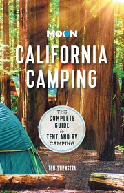
Titles come from Open Library's catalog, matched by subject heading or by title.
Reference
Questions people ask
Do I need a reservation at Cherry Hill Campground?
No. Cherry Hill Campground is first-come, first-served. This campground is non-reservable. Sites are taken on arrival and paid at the fee station.
Source: Forest Service
How much does it cost to camp at Cherry Hill Campground?
$14 per site per night. Pass holders receive a 50% discount on the camping fee, see information board to find out which passes are accepted at this location.
Source: Forest Service
Is Cherry Hill Campground open right now?
Closed for the season as of Oct 26, 2026. Season Mid-May to September.
Source: Forest Service status
Can I bring an RV to Cherry Hill Campground?
Cherry Hill Campground is listed for tents only.
Source: Forest Service
What if Cherry Hill Campground is full?
The nearest public campgrounds are Butte Meadows Campground (3.7 mi, first-come), Potato Patch Campground (6.2 mi, first-come), and Elam Campground (10.4 mi, first-come).
Source: Campgrounds nearby