Sheriff Reservoir Campground
Sheriff Reservoir is a small campground with 5 sites in a tightly forested loop best suited for tents and is located approximately 15 miles to the west of Yampa, CO. Each site has a picnic table and fire grate and there is a vault toilet. This campground does not have potable water so campers should plan to pack in plenty of their own water. Dogs must remain on a leash at all times. Although the views of the reservoir and the Flat Tops are very limited from most sites, the beautiful views are a few steps outside the campground.
More like this: first-come in Colorado · tent only in Colorado

Amenities & rules
| Equipment | Tents |
| Fees | $14 per site. Exact cash or check only as there is no option for change back if paying cash. No credit cards accepted. Payment instructions are found on the kiosk. |
Individual sites vary. Confirm on Recreation.gov or with the managing office.
Season & status
| Status | Open |
| Season | Mid to late June (weather permitting) to October/November (weather permitting) |
| Forest | Medicine Bow-Routt NFs and Thunder Basin NG |
| Booking | No reservations. |
| Fees | $14 per site. Exact cash or check only as there is no option for change back if paying cash. No credit cards accepted. Payment instructions are found on the kiosk. |
| Rules | *Those with campers and trailers may want to check out the large dispersed camping opportunities located along the 4 mile stretch that leads into the campground. Dogs must remain on a leash at all times. |
Medicine Bow-Routt NFs and Thunder Basin NG recreation page ↗
Weather by month
Getting there
| Coordinates | 40.1439° N, 107.1388° W · Directions ↗ |
Supplies & services
| Dump station | Dump station ↗ | 17.6 mi |
| Outdoor gear | Gearhead Outfitters ↗ | 42.2 mi |
Locations © OpenStreetMap contributors. Call ahead; hours change seasonally.
Explore
Worth a stop
- 11.9 mi
Trails nearby
- 0.3 miBlack Mtn Creek ↗5.9 mi trail · hiking, horse, bike
- 0.4 miSand Creek ↗9.7 mi trail · hiking, horse, bike
- 0.4 miBunker Basin3 mi trail · hiking, horse, bike
- 2.3 miBaldy ↗6.8 mi trail · hiking, horse, bike
- 3.3 miSawtooth2 mi trail · hiking, horse, bike, motorcycle and 2 more
- 4 miDunckley Pass ↗0.1 mi trail · hiking, horse, bike
Trailheads within three miles
- 0.4 miSheriff Reservoir Trailhead ↗Medicine Bow-Routt NFs and Thunder Basin NG · Season Mid June (weather dependent) to October/Novemer (Weather dependent)
Trail and trailhead records are the Forest Service's. Distances are straight-line to the nearer trail end. Trail conditions are not tracked here.
Public land it sits in
Flat Tops Wilderness begins about 4.2 miles away, and it is the closest of these.
- 4.2 miFlat Tops Wilderness ↗Wilderness · Forest Service · 230,829 acres
- 7.2 miWhite River National Forest ↗National Forest · Forest Service · 2,482,711 acres
Each unit is published as a centre point and an acreage rather than a boundary, so this section stands it in for a circle of the same area. Whether a campground is inside, and how far it is from one it is outside, are both approximate.
Other campgrounds nearby


On the National Register nearby
- Pyramid Guard StationHistoric district · Yampa · 4.6 mi
- Antlers Cafe and BarBuilding · Yampa · 12.2 mi
- Bell and Canant Mercantile–Crossan's M and A MarketBuilding · Yampa · 12.2 mi
Guidebooks for Colorado
We earn a small commission if you buy through these links. It does not change what we list.
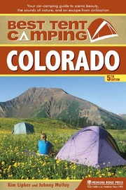
Titles come from Open Library's catalog, matched by subject heading or by title.
Reference
Questions people ask
Do I need a reservation at Sheriff Reservoir Campground?
No. Sheriff Reservoir Campground is first-come, first-served. No reservations. Sites are taken on arrival and paid at the fee station.
Source: Forest Service
How much does it cost to camp at Sheriff Reservoir Campground?
$14 per site. Exact cash or check only as there is no option for change back if paying cash. No credit cards accepted.
Source: Forest Service
Is Sheriff Reservoir Campground open right now?
Open as of Oct 26, 2026. Season Mid to late June (weather permitting) to October/November (weather permitting).
Source: Forest Service status
How many sites does Sheriff Reservoir Campground have?
5 sites.
Source: Forest Service
Can I bring an RV to Sheriff Reservoir Campground?
Sheriff Reservoir Campground is listed for tents only.
Source: Forest Service
What if Sheriff Reservoir Campground is full?
The nearest public campgrounds are Chapman Reservoir Campground (4.1 mi, first-come), Crosho Lake Recreation Area (4.8 mi, first-come), and Bear Lake Campground (7.5 mi, first-come).
Source: Campgrounds nearby