Hammerhorn Campground
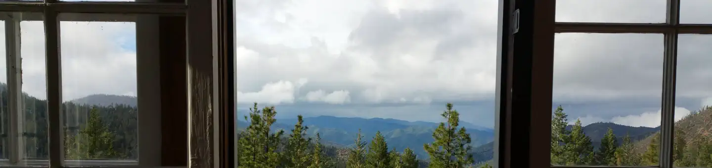
Campground closed due to damage from the 2020 August Complex fires. At Hammerhorn there are nine campsites and three bathrooms including one accessible site and bathroom. There is access to potable water spigots. There is a trailer pull through site. It is not paved. The location is mostly a coniferous/fir forested area with smaller deciduous trees/bushes. The campground sits a short distance above the lake. The accessible trail around the lake is about 40% complete. There is a five-acre lake for trout fishing, however it is not stocked and fishing unavailable due to low water levels.
More like this: first-come in California · tent only in California · accessible sites in California

Amenities & rules
| Equipment | Tents |
| Fees | $8 |
| Accessibility | Accessible facilities include: restroom, picnic tables and the Hammerhorn Trail (1/4 mi.) which leads along the lake shore from the accessible campground to two fully accessible fishing piers |
Individual sites vary. Confirm on Recreation.gov or with the managing office.
Season & status
| Status | Closed for the season. Forest Service sites close for the season; check the official page for the reopening date. |
| Forest | Mendocino National Forest |
| Fees | $8 |
Weather by month
Getting there
| Coordinates | 39.9488° N, 122.9914° W · Directions ↗ |
Fire nearby
- PrescribedAlder Springs Underburn Rx
25 mi from the campground
- PrescribedHarrison Gulch Broadcast Rx
29 mi from the campground
- PrescribedMrrd Programatic Pile Rx
30 mi from the campground
- PrescribedHayfork Watershed Rx
44 mi from the campground
Distance is to the reported incident point, not the fire edge. Call the managing office before you drive.
Supplies & services
| RV sales & service | RV sales & service ↗ | 50.8 mi |
Locations © OpenStreetMap contributors. Call ahead; hours change seasonally.
Explore
Worth a stop
- 1.7 miSmokehouse Ridge Trailhead ↗Trailhead
- 3.1 miSticklake Trailhead ↗Trailhead
Trails nearby
- under 0.1 miHammerhorn Lake0.4 mi trail
- 0.4 miAmandas Answerunder 0.1 mi trail
- 1 miKey Spot0.1 mi trail
- 1 miEnd of the Dayunder 0.1 mi trail
- 1.2 miAnts Place0.3 mi trail
- 1.3 miRough N Readyunder 0.1 mi trail
Trailheads within three miles
- 1.7 miSmokehouse Ridge Trailhead ↗Mendocino National Forest
Trail and trailhead records are the Forest Service's. Distances are straight-line to the nearer trail end. Trail conditions are not tracked here.
Public land it sits in
This campground sits inside Yolla Bolly-Middle Eel Wilderness.
- inYolla Bolly-Middle Eel Wilderness ↗Wilderness · BLM/FS · 182,298 acres
- 0.3 miMendocino National Forest ↗National Forest · Forest Service · 1,073,580 acres
Each unit is published as a centre point and an acreage rather than a boundary, so this section stands it in for a circle of the same area. Whether a campground is inside, and how far it is from one it is outside, are both approximate.
Other campgrounds nearby
Cabin and lookout rentals nearby
Guidebooks for California
We earn a small commission if you buy through these links. It does not change what we list.
Titles come from Open Library's catalog, matched by subject heading or by title.
Reference
Questions people ask
How much does it cost to camp at Hammerhorn Campground?
$8
Source: Forest Service
Is Hammerhorn Campground open right now?
Closed for the season as of Oct 26, 2026.
Source: Forest Service status
Can I bring an RV to Hammerhorn Campground?
Hammerhorn Campground is listed for tents only.
Source: Forest Service
Are there accessible sites at Hammerhorn Campground?
Accessible facilities include: restroom, picnic tables and the Hammerhorn Trail (1/4 mi.) which leads along the lake shore from the accessible campground to two fully accessible fishing piers.
Source: Forest Service
What if Hammerhorn Campground is full?
The nearest public campgrounds are Green Springs Campground (3.7 mi, first-come), Little Doe Campground (3.7 mi, first-come), and Howard Lake Campground (4.9 mi, first-come).
Source: Campgrounds nearby