Pinal & Upper Pinal Campgrounds
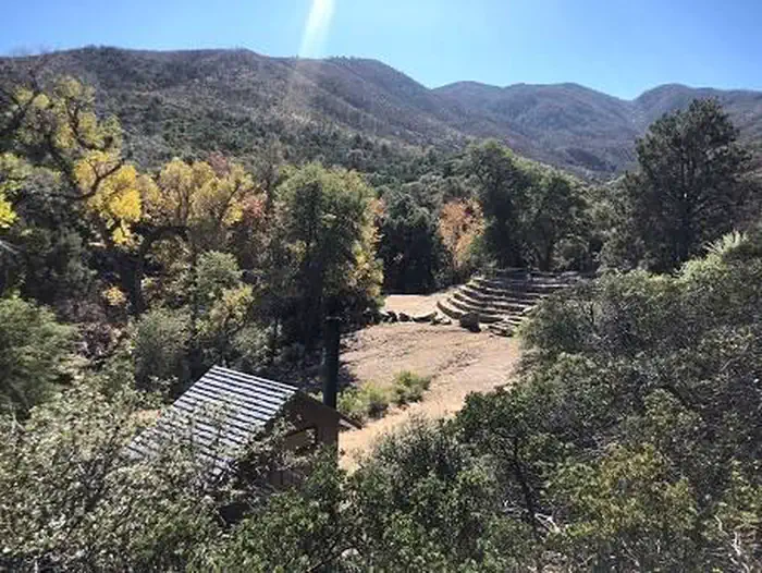
These campgrounds are tucked away in tall stands of ponderosa pines and white fir that offer shade in the hot summer months. Hiking trails are extensive in this area. At least eight trails can be found within one mile of Pinal and Upper Pinal offering spectacular views. Both Pinal and Upper Pinal sites are located on a site formerly occupied by the US Army that used it as a heliographic signaling (using mirrors to reflect sunlight) station during the late 1800s. Pinal, the larger of the two campgrounds, has 13 camp units and Upper Pinal has 3 units.
More like this: first-come in Arizona · tent only in Arizona

Amenities & rules
| Equipment | Tents |
Individual sites vary. Confirm on Recreation.gov or with the managing office.
Season & status
| Status | Open |
| Season | May |
| Forest | Tonto National Forest |
| Rules | 14-day stay limit. Fires in designated areas only, when fires are allowed. Trailers under 32 feet. FR 651 is a narrow winding mountain gravel road suitable for sedans under dry conditions. There are no trash services. Dispose of waste properly. Pack It In, Pack It Out. Leave what you find. Quiet hours 10:00 pm to 6:00 am (running generators are not permitted during quiet hours). |
Weather by month
Getting there
| Coordinates | 33.2845° N, 110.8221° W · Directions ↗ |
Fire nearby
- PrescribedRx Globe Piles Tnf203P
7 mi from the campground
- PrescribedRx Misc Piles Tnf0611P
50 mi from the campground
Distance is to the reported incident point, not the fire edge. Call the managing office before you drive.
Supplies & services
| Dump station | Dump station ↗ | 9.4 mi |
| RV sales & service | RV Park Model Traders ↗ | 45.3 mi |
Locations © OpenStreetMap contributors. Call ahead; hours change seasonally.
Explore
Trails nearby
- 0.1 miMiddle0.5 mi trail · hiking, horse, bike
- 0.2 miFerndell0.8 mi trail · hiking, horse, bike
- 0.3 miSixshooter Canyon ↗6 mi trail · hiking, horse, bike · national_recreation_or_other
- 0.3 miPioneer2.3 mi trail · hiking, horse, bike
- 0.4 miBobtail Ridge3.3 mi trail · hiking, horse, bike
- 0.6 miPineline0.8 mi trail · hiking, horse, bike
Trail and trailhead records are the Forest Service's. Distances are straight-line to the nearer trail end. Trail conditions are not tracked here.
Public land it sits in
Tonto National Forest begins about 9.9 miles away, and it is the closest of these.
- 9.9 miTonto National Forest ↗National Forest · Forest Service · 2,966,417 acres
- 13 miNeedle's Eye Wilderness ↗Wilderness · Bureau of Land Management · 8,760 acres
Each unit is published as a centre point and an acreage rather than a boundary, so this section stands it in for a circle of the same area. Whether a campground is inside, and how far it is from one it is outside, are both approximate.
Other campgrounds nearby


On the National Register nearby
- Gila PuebloBuilding · Globe · 6.4 mi
- Pinal Ranger StationBuilding · Globe · 7.1 mi
- Besh-Ba-GowahSite · Globe · 7.3 mi
Guidebooks for Tonto National Forest and Arizona
We earn a small commission if you buy through these links. It does not change what we list.
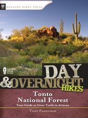
Titles come from Open Library's catalog, matched by subject heading or by title.
Reference
Questions people ask
Is Pinal & Upper Pinal Campgrounds open right now?
Open as of Oct 26, 2026. Season May.
Source: Forest Service status
Can I bring an RV to Pinal & Upper Pinal Campgrounds?
Pinal & Upper Pinal Campgrounds is listed for tents only.
Source: Forest Service
What if Pinal & Upper Pinal Campgrounds is full?
The nearest public campgrounds are Sulphide Del Rey Campground (2.8 mi, first-come), Kellner Group Campground (3.5 mi), and Oak Flat Campground (13.3 mi, first-come).
Source: Campgrounds nearby