China Hat Campground
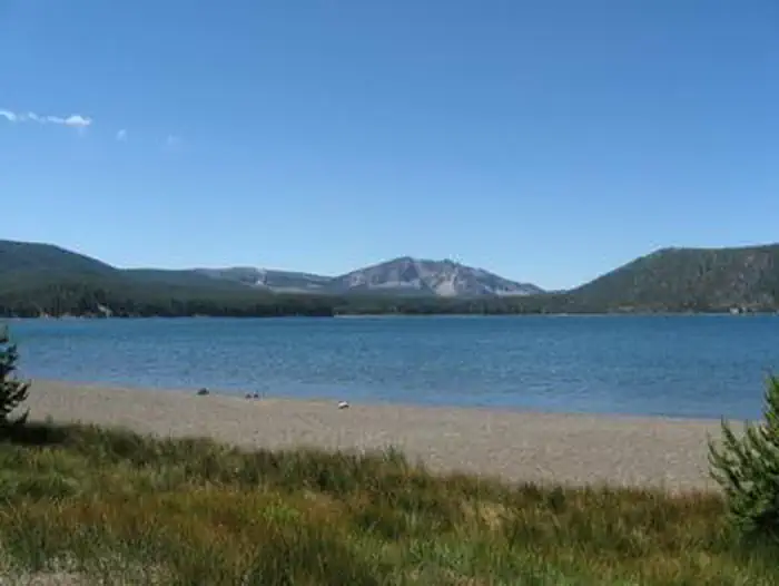
This campground is located near China Hat, a tall (6,573 ft. elevation), cone-shaped formation. The campground is shaded by lodgepole and ponderosa pine trees and lies in the heart of the East Fort Rock OHV Trail System. This campground is also a popular area for hunters during deer season. The campground has 13 designated campsites, with picnic tables and firerings. There are 2 areas of adjoining sites that will accommodate small groups and large RVs. A vault toilet is located within the campground.
More like this: first-come in Oregon · free in Oregon · tent only in Oregon

Amenities & rules
| Equipment | Tents |
| Fees | No fee. |
Individual sites vary. Confirm on Recreation.gov or with the managing office.
Season & status
| Status | Temporarily closed |
| Season | Open as accessible |
| Forest | Deschutes National Forest |
| Fees | No fee. |
Weather by month
Getting there
| Coordinates | 43.6583° N, 121.0360° W · Directions ↗ |
Fire nearby
- PrescribedBridge Buck Rx 2026
42 mi from the campground
- PrescribedRabbit 42 Rx
44 mi from the campground
- PrescribedSting 6 Rx
46 mi from the campground · 42 acres
Distance is to the reported incident point, not the fire edge. Call the managing office before you drive.
Supplies & services
| Dump station | Dump station ↗ | 8.9 mi |
| RV sales & service | Blue Compass RV Bend ↗ | 29.8 mi |
| Outdoor gear | The Supply Depot ↗ | 30.2 mi |
Locations © OpenStreetMap contributors. Call ahead; hours change seasonally.
Explore
Video
East Fort Rock OHV Campground China Hat Deschutes Forest Bend, Oregon Drone Test
Worth a stop
- 4.4 miSouth Lava Ohv Staging Area ↗OHV / range
- 8.6 miRoad 25 Ohv Staging Area ↗OHV / range
- 11 miLittle Crater Day Use Site ↗Day use
- 12.5 miPaulina Peak Trailhead ↗Trailhead
Trails nearby
- 0.1 miOHV #080.2 mi trail · hiking, horse, bike, motorcycle and 2 more
- 0.4 miOHV #32 ↗9.5 mi trail · hiking, horse, bike, motorcycle and 2 more
- 0.8 miOHV #383.1 mi trail · hiking, horse, bike, motorcycle and 2 more
- 1.6 miOHV #550.9 mi trail · hiking, horse, bike, motorcycle and 2 more
- 1.7 miOHV #352.6 mi trail · hiking, horse, bike, motorcycle and 2 more
- 2.1 miOHV #75 ↗5.8 mi trail · hiking, horse, bike, motorcycle and 2 more
Trail and trailhead records are the Forest Service's. Distances are straight-line to the nearer trail end. Trail conditions are not tracked here.
Public land it sits in
This campground sits inside Deschutes National Forest.
- inDeschutes National Forest ↗National Forest · Forest Service · 1,870,116 acres
Each unit is published as a centre point and an acreage rather than a boundary, so this section stands it in for a circle of the same area. Whether a campground is inside, and how far it is from one it is outside, are both approximate.
Other campgrounds nearby



On the National Register nearby
- I.O.O.F. Organization Camp, Paulina LakeHistoric district · LaPine · 11.6 mi
- Cabin Lake Guard StationBuilding · Bend · 11.6 mi
- Paulina Lake Guard StationBuilding · Bend · 12.6 mi
Guidebooks for Oregon
We earn a small commission if you buy through these links. It does not change what we list.
Titles come from Open Library's catalog, matched by subject heading or by title.
Reference
Questions people ask
How much does it cost to camp at China Hat Campground?
Nothing. China Hat Campground is listed as free. No fee.
Source: Forest Service
Is China Hat Campground open right now?
Temporarily closed as of Oct 26, 2026. Season Open as accessible.
Source: Forest Service status
Can I bring an RV to China Hat Campground?
China Hat Campground is listed for tents only.
Source: Forest Service
What if China Hat Campground is full?
The nearest public campgrounds are East Lake Campground (9.7 mi), Cinder Hill Campground (9.8 mi), and Little Crater Campground (11 mi).
Source: Campgrounds nearby