Hannagan Campground
At 9,100 feet, Hannagan campground is one of the highest campgrounds in Arizona. Being so high up, you might suspect that the weather is cool at Hannagan campground. It is! In fact, it is deliciously cool while everywhere else is hot. You might also suspect that the surroundings are alpine. Right again! High country tree species such as Colorado Blue and Engelmann spruce, subalpine and corkbark fir and quaking aspen shade these campgrounds. There are also nearby hiking trails, scenic drives and Hannagan campground is close to the primitive area and wilderness.
More like this: first-come in Arizona · free in Arizona · tent only in Arizona

Amenities & rules
| Equipment | Tents |
| Fees | No fees - donations gratefully accepted |
Individual sites vary. Confirm on Recreation.gov or with the managing office.
Season & status
| Status | Open |
| Season | May 15 |
| Forest | Apache-Sitgreaves National Forest |
| Fees | No fees - donations gratefully accepted |
Weather by month
Getting there
| Coordinates | 33.6359° N, 109.3279° W · Directions ↗ |
Fire nearby
- PrescribedD6 - Heifer Rx
10 mi from the campground · 3,116 acres
- PrescribedD3 Hagen Rx
12 mi from the campground · 5,757 acres
- PrescribedD6 Wallow West Unit 6 Rx
13 mi from the campground · 7,605 acres
- PrescribedD3 Bear Rx
14 mi from the campground · 5,072 acres
Distance is to the reported incident point, not the fire edge. Call the managing office before you drive.
Supplies & services
| Dump station | Dump station ↗ | 17 mi |
| RV sales & service | Trek RV ↗ | 59.5 mi |
Locations © OpenStreetMap contributors. Call ahead; hours change seasonally.
Explore
Video
Video of Hannagan Campground - Apache Sitgreaves National Forests, AZ from Beth G.
Worth a stop
- under 0.1 miHannagan/Aker Lake Trailhead ↗Trailhead
- 0.3 miHannagan Snowmobile Trailhead ↗Trailhead
- 1.7 miAker Lake Fishing Site ↗Fishing site
- 10.9 miSheep Saddle Picnic Site ↗Day use
- 13.3 miRose Peak Picnic Site ↗Day use
Trails nearby
- 0.2 miHorseshoe Cienega ↗9 mi trail · hiking, horse, bike, snowshoe and 1 more
- 0.3 miClell Lee Loop ↗8.4 mi trail · hiking, horse, bike, snowshoe and 1 more
- 0.3 miFoote Creek A3.7 mi trail · hiking, horse
- 0.4 miSteeple ↗26.8 mi trail · hiking, horse, snowshoe, ski
- 1.1 miUpper Grant4.3 mi trail · hiking, horse
- 1.3 miAker Lake ↗9.1 mi trail · hiking, horse, bike, snowshoe and 1 more
Trailheads within three miles
- under 0.1 miHannagan/Aker Lake Trailhead ↗Apache-Sitgreaves National Forest
- under 0.1 miSteeple/Foote Creek Trailhead ↗Apache-Sitgreaves National Forest
- 0.3 miHannagan Snowmobile Trailhead ↗Apache-Sitgreaves National Forest
- 2.1 miNorth Fork/KP Rim Trailhead ↗Apache-Sitgreaves National Forest
Trail and trailhead records are the Forest Service's. Distances are straight-line to the nearer trail end. Trail conditions are not tracked here.
Public land it sits in
This campground sits inside Apache-Sitgreaves National Forests.
- inApache-Sitgreaves National Forests ↗National Forest · Forest Service · 2,110,688 acres
- 5.3 miBear Wallow Wilderness ↗Wilderness · Forest Service · 11,235 acres
- 13.8 miGila National Forest ↗National Forest · Forest Service · 3,389,394 acres
Each unit is published as a centre point and an acreage rather than a boundary, so this section stands it in for a circle of the same area. Whether a campground is inside, and how far it is from one it is outside, are both approximate.
Other campgrounds nearby


Cabin and lookout rentals nearby
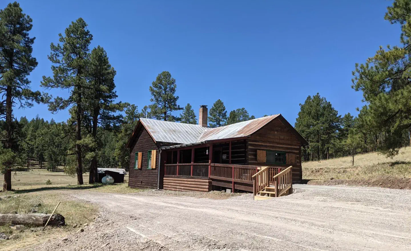
On the National Register nearby
- Ps Knoll Lookout ComplexStructure · Maverick · 9.1 mi
- Bear Mountain Lookout ComplexStructure · Mogollon Rim · 12.7 mi
Guidebooks for Arizona
We earn a small commission if you buy through these links. It does not change what we list.
- Best Backpacking Trips in Utah, Arizona, and New MexicoMike White and Douglas Lorain, 2016Find at Bookshop.org
Titles come from Open Library's catalog, matched by subject heading or by title.
Reference
Questions people ask
Do I need a reservation at Hannagan Campground?
No. Hannagan Campground is first-come, first-served. Sites are taken on arrival and paid at the fee station.
Source: Forest Service
How much does it cost to camp at Hannagan Campground?
Nothing. Hannagan Campground is listed as free. No fees - donations gratefully accepted
Source: Forest Service
Is Hannagan Campground open right now?
Open as of Oct 26, 2026. Season May 15.
Source: Forest Service status
Can I bring an RV to Hannagan Campground?
Hannagan Campground is listed for tents only.
Source: Forest Service
What if Hannagan Campground is full?
The nearest public campgrounds are KP Cienega Campground (4 mi, first-come), Horse Springs Campground (10.6 mi, first-come), and Horse Springs Group Ramada/Campground (10.6 mi, first-come).
Source: Campgrounds nearby