Kehl Springs Campground
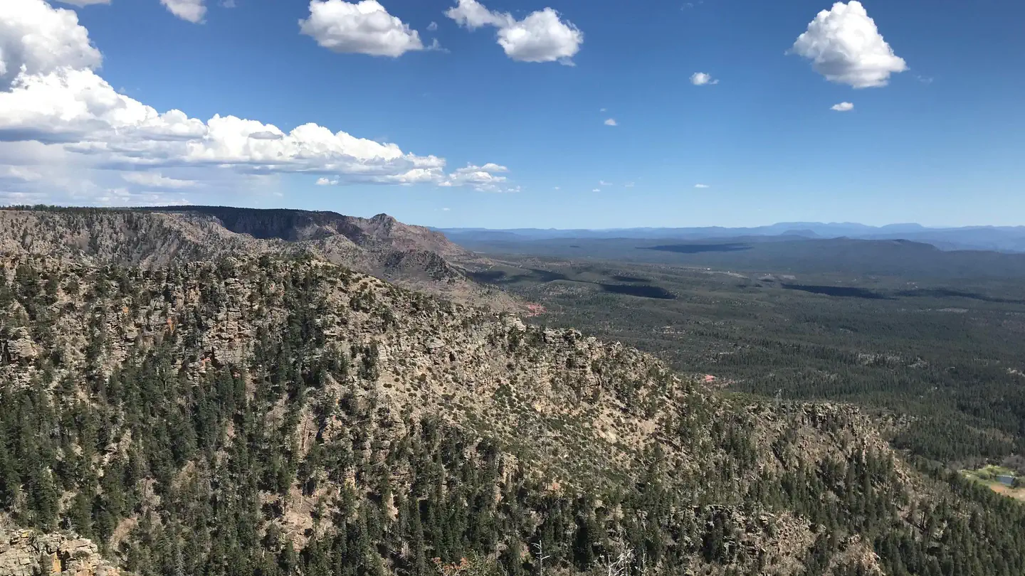
Kehl Springs Camp is located in a stand of ponderosa pines right at the brink of one of Arizona's most awesome geologic features, the Mogollon Rim. Just a short distance from these shady campsites the rim brings the Colorado Plateau to an end with a precipitous drop-off that plunges two thousand feet from forested highland to Sonoran desert. From this high perspective you can enjoy spectacular views of Four Peaks, the Sierra Anchas, and the Mazatzals. At night, the lights of Payson wink up from 2,000 feet down and 15 miles away. Other recreation activities to enjoy nearby include hiking, mountain biking, fishing and boating.
More like this: first-come in Arizona · free in Arizona · tent only in Arizona

Amenities & rules
| Equipment | Tents |
Individual sites vary. Confirm on Recreation.gov or with the managing office.
Season & status
| Status | Closed for the season. Forest Service sites close for the season; check the official page for the reopening date. |
| Season | May to October 27 |
| Forest | Coconino National Forest Recreation |
| Rules | Seasonal closures or fire restrictions/closures may be in place. During both Stage 1 and Stage 2 Fire Restrictions, campfires are prohibited at this site. Gas operated devices with an on/off switch are allowed. Quiet hours: 10 p.m. to 6 a.m. (running generators not permitted during quiet hours) |
Weather by month
Getting there
| Coordinates | 34.4357° N, 111.3171° W · Directions ↗ |
Fire nearby
- PrescribedRx Rim Country Tnf0409B
11 mi from the campground
- PrescribedD2 Vincent Rx
20 mi from the campground · 2,258 acres
- PrescribedD2 Dye Rx
23 mi from the campground · 5,246 acres
- PrescribedWolfe-Tillman Rx
25 mi from the campground · 50 acres
Distance is to the reported incident point, not the fire edge. Call the managing office before you drive.
Supplies & services
| Dump station | Dump station ↗ | 11.4 mi |
| Outdoor gear | The Hike House ↗ | 38.8 mi |
| RV sales & service | Little Dealer Little Prices ↗ | 57.5 mi |
Locations © OpenStreetMap contributors. Call ahead; hours change seasonally.
Explore
Video
Beautiful 🌻Small KEHL SPRING Campground, Arizona
Trails nearby
- 1.8 miEast Webber3.1 mi trail · hiking, horse, bike
- 3.2 miCol Devin ↗2 mi trail · hiking, horse, bike · national_scenic_or_historic
- 3.6 miGeronimo1.8 mi trail · hiking, horse, bike
- 4.1 miFred Haught ↗6.5 mi trail · national_scenic_or_historic
- 4.1 miTurkey Springs2.5 mi trail · hiking, horse
- 4.3 miWest Webber2.1 mi trail · hiking, horse
Trail and trailhead records are the Forest Service's. Distances are straight-line to the nearer trail end. Trail conditions are not tracked here.
Public land it sits in
Tonto National Forest begins about 0.6 miles away, and it is the closest of these.
- 0.6 miTonto National Forest ↗National Forest · Forest Service · 2,966,417 acres
- 4.2 miCoconino National Forest ↗National Forest · Forest Service · 2,000,952 acres
- 10.4 miFossil Springs Wilderness ↗Wilderness · Forest Service · 10,431 acres
Each unit is published as a centre point and an acreage rather than a boundary, so this section stands it in for a circle of the same area. Whether a campground is inside, and how far it is from one it is outside, are both approximate.
Other campgrounds nearby



Cabin and lookout rentals nearby
On the National Register nearby
- Hunt Farmstead Historic DistrictHistoric district · Pine · 8.4 mi
- Pryor Miller HouseBuilding · Pine · 8.6 mi
- Pine Community Center Historic DistrictHistoric district · Pine · 8.6 mi
Guidebooks for Arizona
We earn a small commission if you buy through these links. It does not change what we list.
- Best Backpacking Trips in Utah, Arizona, and New MexicoMike White and Douglas Lorain, 2016Find at Bookshop.org
Titles come from Open Library's catalog, matched by subject heading or by title.
Reference
Questions people ask
How much does it cost to camp at Kehl Springs Campground?
Nothing. Kehl Springs Campground is listed as free.
Source: Forest Service
Is Kehl Springs Campground open right now?
Closed for the season as of Oct 26, 2026. Season May to October 27.
Source: Forest Service status
Can I bring an RV to Kehl Springs Campground?
Kehl Springs Campground is listed for tents only.
Source: Forest Service
What if Kehl Springs Campground is full?
The nearest public campgrounds are Long Valley Group Campground (6 mi), Clints Well Campground (8.3 mi, first-come), and Rock Crossing Campground (10.5 mi, partly first-come).
Source: Campgrounds nearby