Third Fork Campground
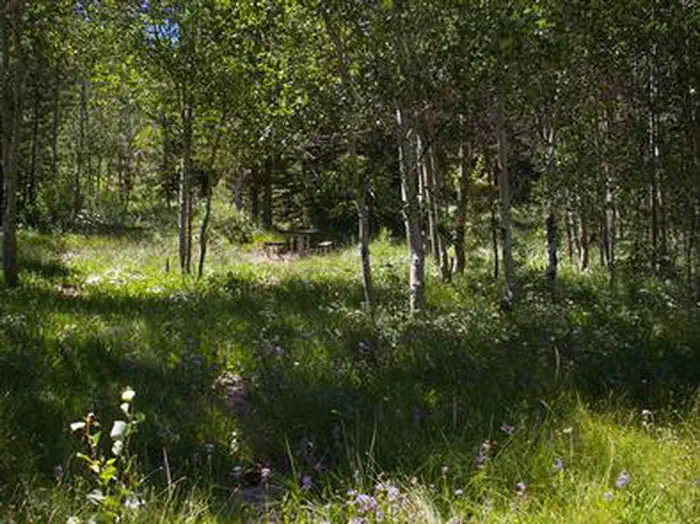
Closed due to fire damage. Third Fork Trailhead Picnic and Campground area is composed of 5 individual units and an accessible vault toilet. This area is suitable for motor homes and trailers and best suited for day use. Barrier free stock loading is available. Amenities include toilets and an accessible transfer station. Third Fork Trail (#004) is an easy multi-use trail that accesses an extensive trail system including Wahlstrom Hollow (#38) and Rim View Trails (#235), the latter a hiking/horse trail over moderate terrain. Rim View Trail is 9.5 miles long and runs from Buckskin Ridge to the confluence of Third and Fourth Forks of Rock Creek; it is open to foot and horse travel only.
More like this: first-come in Idaho · tent only in Idaho

Amenities & rules
| Equipment | Tents |
Individual sites vary. Confirm on Recreation.gov or with the managing office.
Season & status
| Status | Temporarily closed |
| Season | May |
| Forest | Sawtooth National Forest |
| Rules | The following act is prohibited within the Minidoka Ranger District: Pursuant to 36 CFR 262.58 (a), camping in any area including a developed recreation site or an undeveloped/dispersed recreation site for more than 14 (fourteen) days in a 28 (twenty-eight) day period. |
Weather by month
Getting there
| Coordinates | 42.2532° N, 114.2494° W · Directions ↗ |
Fire nearby
- PrescribedGoose Creek Single Tree Rx
11 mi from the campground · 35 acres
- PrescribedStinson Creek Rx 2026
29 mi from the campground · 450 acres
Distance is to the reported incident point, not the fire edge. Call the managing office before you drive.
Supplies & services
| Outdoor gear | Xtreme RV ↗ | 22.6 mi |
| Dump station | Dump station ↗ | 33.6 mi |
Locations © OpenStreetMap contributors. Call ahead; hours change seasonally.
Explore
Worth a stop
- 3.2 mi
Trails nearby
- 0.1 miRim View ↗9.5 mi trail · hiking, horse, bike
- 0.1 miThird Fork Rock Cr ↗7.7 mi trail · hiking, horse, bike, motorcycle and 2 more
- 0.4 miWahlstrom Hollow3.1 mi trail · hiking, horse, bike, motorcycle and 1 more
- 1.6 miSecond Fork ↗5.5 mi trail · hiking, horse, bike, motorcycle and 1 more
- 2.6 miA-H Creek1.2 mi trail · hiking, horse, bike, motorcycle and 1 more
- 2.7 miPike Mountain ↗4.5 mi trail · hiking, horse, bike, motorcycle and 2 more
Trail and trailhead records are the Forest Service's. Distances are straight-line to the nearer trail end. Trail conditions are not tracked here.
Other campgrounds nearby

On the National Register nearby
- Pleasant Valley SchoolBuilding · Kimberly · 14.6 mi
- Stricker Store and FarmBuilding · Twin Falls · 14.7 mi
Guidebooks for Idaho
We earn a small commission if you buy through these links. It does not change what we list.
Titles come from Open Library's catalog, matched by subject heading or by title.
Reference
Questions people ask
Is Third Fork Campground open right now?
Temporarily closed as of Oct 26, 2026. Season May.
Source: Forest Service status
Can I bring an RV to Third Fork Campground?
Third Fork Campground is listed for tents only.
Source: Forest Service
What if Third Fork Campground is full?
The nearest public campgrounds are Steer Basin Campground (1.9 mi, first-come), Lower Penstemon (4.4 mi), and Upper Penstemon Campground (4.5 mi, first-come).
Source: Campgrounds nearby