Clear Lake North Group Campground
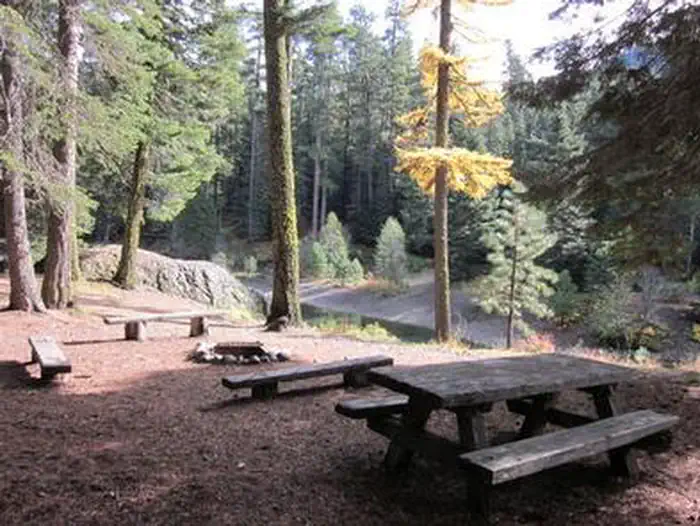
Clear Lake Group Campground is along the North Fork of the Tieton River. The campground sits between popular Rimrock Lake and the quieter Clear Lake beneath a canopy of towering pine and fir trees. Perched on a rocky bluff overlooking the area, this secluded spot offers access to a variety of recreational opportunities. It is an ideal setting for large family and group gatherings.
This is the group site. Looking for the main campground? Clear Lake North Campground, 33 sites, is next door.
More like this: reservable in Washington · tent only in Washington

Amenities & rules
| Equipment | Tents |
| Fees | Daily Fee - $60.00 |
Individual sites vary. Confirm on Recreation.gov or with the managing office.
Season & status
| Status | Closed for the season. Forest Service sites close for the season; check the official page for the reopening date. |
| Forest | Okanogan-Wenatchee National Forest |
| Booking | This site can be reserved by calling Toll Free 1-877-444-6777 (International 518-885-3639 or TDD 877-833-6777) or on-line at recreation.gov |
| Fees | Daily Fee - $60.00 |
| Rules | Maximum 40 people and 10 vehicles. |
Weather by month
Getting there
| Coordinates | 46.6311° N, 121.2667° W · Directions ↗ |
Fire nearby
- PrescribedMeloy Co-Op Rx
20 mi from the campground · 1 acres
- WildfireGarda Falls
29 mi from the campground · 308 acres · 0% contained
- WildfireWest Fork
30 mi from the campground · 310 acres · 16% contained
- PrescribedNaches Programmatic Pile Rx
31 mi from the campground
Distance is to the reported incident point, not the fire edge. Call the managing office before you drive.
Supplies & services
| Dump station | Dump station ↗ | 4.1 mi |
| RV sales & service | RV sales & service ↗ | 31.2 mi |
| Outdoor gear | RMI Rentals ↗ | 37.5 mi |
Locations © OpenStreetMap contributors. Call ahead; hours change seasonally.
Explore
Video
Is Clear Lake in California a Nice Place?
Worth a stop
- 3.2 miHorseshoe Cove Boat Launch ↗Boat launch
- 4.7 miDog Lake Day Use/Boat Launch/Trailhead ↗Boat launch
- 5.6 miSection 3 Lake Trailhead ↗Trailhead
- 8 miTrailhead: Sand Lake ↗Trailhead
Trails nearby
- 0.5 miPinegrass Snowmobile ↗4.8 mi trail
- 0.9 miLeafy Arches1.1 mi trail
- 0.9 miWay Through the Wilds0.9 mi trail
- 0.9 miClear Lake Barrier Free0.5 mi trail
- 1.1 miTwilight Trail0.7 mi trail
- 1.1 miStreamside Pass0.9 mi trail
Trailheads within three miles
- 2.3 miAndy Creek Trailhead ↗Okanogan-Wenatchee National Forest
Trail and trailhead records are the Forest Service's. Distances are straight-line to the nearer trail end. Trail conditions are not tracked here.
Public land it sits in
William O. Douglas Wilderness begins about 2.4 miles away, and it is the closest of these.
- 2.4 miWilliam O. Douglas Wilderness ↗Wilderness · Forest Service · 168,955 acres
- 3.5 miGoat Rocks Wilderness ↗Wilderness · Forest Service · 108,020 acres
- 10.9 miGifford Pinchot National Forest ↗National Forest · Forest Service · 1,496,308 acres
Each unit is published as a centre point and an acreage rather than a boundary, so this section stands it in for a circle of the same area. Whether a campground is inside, and how far it is from one it is outside, are both approximate.
Other campgrounds nearby


Cabin and lookout rentals nearby
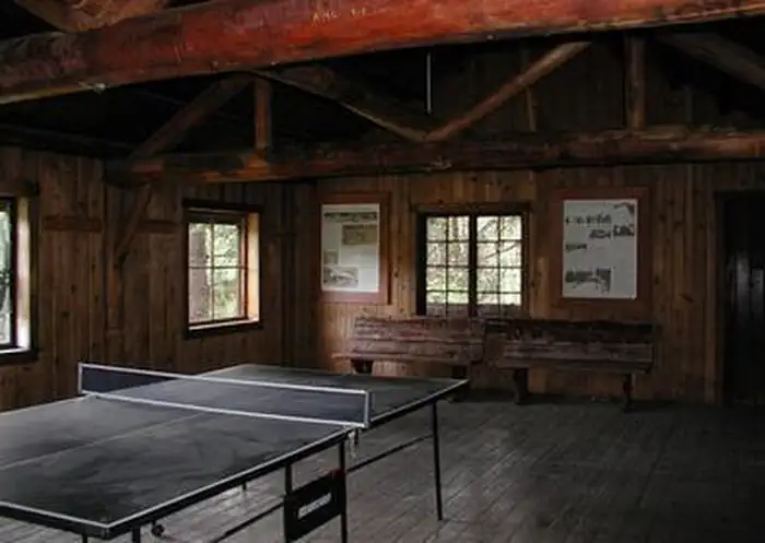

Historic landmarks nearby


Guidebooks for Washington
We earn a small commission if you buy through these links. It does not change what we list.
Titles come from Open Library's catalog, matched by subject heading or by title.
Reference
Questions people ask
Do I need a reservation at Clear Lake North Group Campground?
Sites at Clear Lake North Group Campground are reservable on Recreation.gov. This site can be reserved by calling Toll Free 1-877-444-6777 (International 518-885-3639 or TDD 877-833-6777) or on-line at recreation.gov Any walk-up sites are listed on the booking page.
Source: Forest Service
How much does it cost to camp at Clear Lake North Group Campground?
Daily Fee - $60.00
Source: Forest Service
Is Clear Lake North Group Campground open right now?
Closed for the season as of Oct 26, 2026.
Source: Forest Service status
Can I bring an RV to Clear Lake North Group Campground?
Clear Lake North Group Campground is listed for tents only.
Source: Forest Service
What if Clear Lake North Group Campground is full?
The nearest public campgrounds are Clear Lake Group Site (0.1 mi), Clear Lake North Campground (0.1 mi, first-come), and Indian Creek Campground (1.5 mi).
Source: Campgrounds nearby