Trout Creek Campground
Description: Trout Creek is one of the few sizable creeks on the McCloud Flats, and is a popular undeveloped camping area. Vault toilets are provided, but there are no tables at these dispersed sites. Bring your own drinking water. There is no trash/garbage service. Please pack out your trash. 15 day stay limit. Features: In recent years, the Forest Service has partnered with other agencies and organizations to restore this area to its traditional habitat with improvements to the hydrology of the creek bed and propagation of native species. There is a protective perimeter fence to keep out cattle and OHV use. Access includes 1 mile of unpaved road.
More like this: first-come in California · free in California · tent only in California

Amenities & rules
| Equipment | Tents |
| Fees | No fee |
Individual sites vary. Confirm on Recreation.gov or with the managing office.
Season & status
| Forest | Shasta-Trinity National Forest |
| Booking | no |
| Fees | No fee |
Weather by month
Getting there
| Coordinates | 41.4453° N, 121.8856° W · Directions ↗ |
Fire nearby
- PrescribedSnowmans Understory Rx
21 mi from the campground
- PrescribedMcbride Underburn Rx
22 mi from the campground
- PrescribedMcbride Underburn Rx
23 mi from the campground
Distance is to the reported incident point, not the fire edge. Call the managing office before you drive.
Supplies & services
| Dump station | Dump station ↗ | 18.5 mi |
| Outdoor gear | The Sportsmens Den ↗ | 23.9 mi |
| RV sales & service | Cousin Gary RV Center ↗ | 59.8 mi |
Locations © OpenStreetMap contributors. Call ahead; hours change seasonally.
Explore
Trails nearby
- under 0.1 miTrout Creek Nature0.5 mi trail · hiking, horse, bike
- 0.2 miRainbow ↗9.8 mi trail · snowmobile, snowshoe, ski, snowcoach
- 0.8 miHorse Peak ↗5.8 mi trail · snowmobile, snowshoe, ski, snowcoach
- 3.5 miAsperin ↗4.7 mi trail · snowmobile, snowshoe, ski, snowcoach
- 3.8 miStevens Pass ↗5.3 mi trail
- 3.8 miUpper Antelope Creek ↗11 mi trail
Trail and trailhead records are the Forest Service's. Distances are straight-line to the nearer trail end. Trail conditions are not tracked here.
Public land it sits in
This campground sits inside Klamath National Forest.
- inKlamath National Forest ↗National Forest · Forest Service · 1,705,451 acres
- 12.4 miMt. Shasta Wilderness ↗Wilderness · Forest Service · 36,981 acres
Each unit is published as a centre point and an acreage rather than a boundary, so this section stands it in for a circle of the same area. Whether a campground is inside, and how far it is from one it is outside, are both approximate.
Other campgrounds nearby


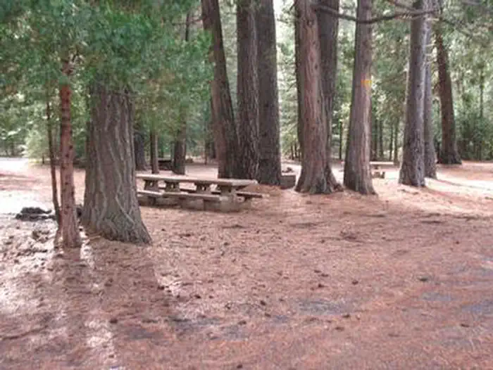
Cabin and lookout rentals nearby
Guidebooks for California
We earn a small commission if you buy through these links. It does not change what we list.
Titles come from Open Library's catalog, matched by subject heading or by title.
Reference
Questions people ask
How much does it cost to camp at Trout Creek Campground?
Nothing. Trout Creek Campground is listed as free. No fee
Source: Forest Service
Can I bring an RV to Trout Creek Campground?
Trout Creek Campground is listed for tents only.
Source: Forest Service
What if Trout Creek Campground is full?
The nearest public campgrounds are Harris Spring Campground (5.3 mi, first-come), Algoma Campground (13.1 mi, first-come), and Cattle Camp (13.1 mi, first-come).
Source: Campgrounds nearby