Wapaloosie Horse Campground
Wapaloosie is a small campground with a circular drive and two pull-thru campsites for trucks with trailers. It is a wonderful (circle the wagons) experience for Pack and Saddle enthusiasts. Amenities such as hitching posts, hayfeeder and a nearby creek make it a destination for equestrian use. The Wapaloosie Trail #15 is a short 2.7 mile ride/hike to access the 44.6 mile Kettle Crest National Scenic Trail. This area and its trails offer panoramic views of the surrounding mountains, abundant wildlife, wildflowers, incredible sunrises and sunsets. This multiple use recreation area also brings many hikers and mountain bikers to explore the vast landscape.
More like this: first-come in Washington · free in Washington · tent only in Washington

active
Amenities & rules
| Equipment | Tents |
| Fees | No Fee |
Individual sites vary. Confirm on Recreation.gov or with the managing office.
Season & status
| Status | Closed for the season. Forest Service sites close for the season; check the official page for the reopening date. |
| Season | Memorial Day Weekend to October 27 |
| Forest | Colville National Forest |
| Fees | No Fee |
| Rules | Quiet hours between 10 p.m. and 6 a.m. Campfire in developed fire ring only. Fireworks are prohibited. Pets must be on leash. OHV use prohibited in the campground. Maximum length of stay: 14 days. Food and wildlife attractants must be properly stored at all times |
Weather by month
Getting there
| Coordinates | 48.6637° N, 118.4398° W · Directions ↗ |
Fire nearby
- PrescribedRep Rx - Walker Hp
5 mi from the campground
- Prescribed3R Rx - Pass Mp
5 mi from the campground
- PrescribedRep Rx - Walker 50
7 mi from the campground · 313 acres
- Prescribed3R Rx - Coyote
9 mi from the campground · 841 acres
Distance is to the reported incident point, not the fire edge. Call the managing office before you drive.
Supplies & services
| Dump station | Dump station ↗ | 10.8 mi |
| Outdoor gear | Boulder Creek Saddle Shop ↗ | 18 mi |
| RV sales & service | RV sales & service ↗ | 51.3 mi |
Locations © OpenStreetMap contributors. Call ahead; hours change seasonally.
Explore
Trails nearby
- under 0.1 miWapaloosie2.7 mi trail · hiking, horse, bike
- 1.2 miMack/King MT ↗9.8 mi trail · hiking, horse, bike, motorcycle and 4 more
- 1.2 miTwin Sisters ↗7.5 mi trail · hiking, horse, bike, motorcycle and 4 more
- 1.3 miTimber Ridge2.9 mi trail · hiking, horse, bike
- 2.1 miSherman Pass4.2 mi trail · hiking, horse, bike
- 2.1 miMarcus3.5 mi trail · hiking, horse, bike
Trail and trailhead records are the Forest Service's. Distances are straight-line to the nearer trail end. Trail conditions are not tracked here.
Public land it sits in
This campground sits inside Colville National Forest.
- inColville National Forest ↗National Forest · Forest Service · 1,752,994 acres
Each unit is published as a centre point and an acreage rather than a boundary, so this section stands it in for a circle of the same area. Whether a campground is inside, and how far it is from one it is outside, are both approximate.
Other campgrounds nearby

Cabin and lookout rentals nearby
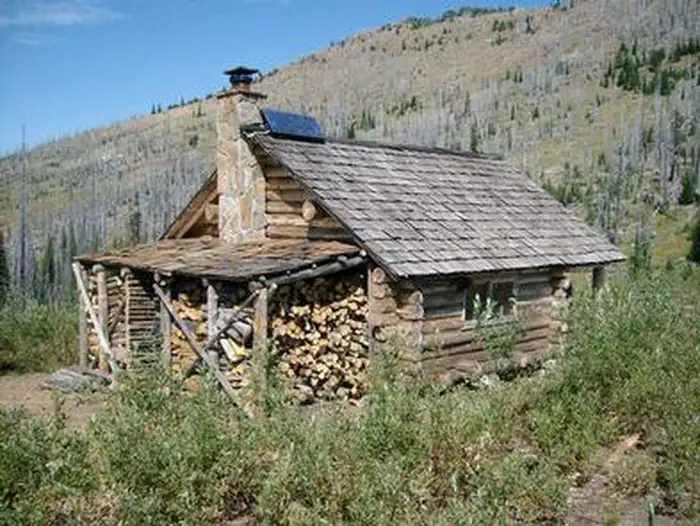
On the National Register nearby
- Fairweather–Trevitt HouseBuilding · Republic · 9.3 mi
- Creaser HotelBuilding · Republic · 13.5 mi
- Ferry County CourthouseBuilding · Republic · 13.5 mi
Guidebooks for Washington
We earn a small commission if you buy through these links. It does not change what we list.
Titles come from Open Library's catalog, matched by subject heading or by title.
Reference
Questions people ask
Do I need a reservation at Wapaloosie Horse Campground?
No. Wapaloosie Horse Campground is first-come, first-served. Sites are taken on arrival and paid at the fee station.
Source: Forest Service
How much does it cost to camp at Wapaloosie Horse Campground?
Nothing. Wapaloosie Horse Campground is listed as free. No Fee
Source: Forest Service
Is Wapaloosie Horse Campground open right now?
Closed for the season as of Oct 26, 2026. Season Memorial Day Weekend to October 27.
Source: Forest Service status
Can I bring an RV to Wapaloosie Horse Campground?
Wapaloosie Horse Campground is listed for tents only.
Source: Forest Service
What if Wapaloosie Horse Campground is full?
The nearest public campgrounds are Jungle Hill Horse Campground (2 mi, first-come), Sherman Overlook (4.2 mi), and Lambert Creek Horse Camp (5.9 mi, first-come).
Source: Campgrounds nearby