Camp 32
The Camp 32 campground is located 15 miles southwest of Eureka off Pinkham Creek road 7182. The campground 8 sites with tables, fire rings. Accommodating up to a 20' rv. Amenities include potable water, vault toilets and a large open field. Camp 32 was a logging camp established in 1924 by the Bonners Ferry Lumber Company and operated for approximately 2 years. The land was acquired from early homesteader, Margaret Durall. The site included several out buildings. A company store and several small cabins.
More like this: first-come in Montana · tent only in Montana

Amenities & rules
| Equipment | Tents |
| Fees | $0.00 Pack in/Pack out |
Individual sites vary. Confirm on Recreation.gov or with the managing office.
Season & status
| Forest | Kootenai National Forest |
| Fees | $0.00 Pack in/Pack out |
| Rules | 14 day stay limit on all National Forest System Lands Pets are welcome, but must be leashed. Lighting of fireworks is not allowed on National Forest System Lands. |
Weather by month
Getting there
| Coordinates | 48.8352° N, 115.1946° W · Directions ↗ |
Fire nearby
- PrescribedGv Frozen Moose Rx
36 mi from the campground
- PrescribedD4 Border Raid - Rx
44 mi from the campground
- PrescribedTl Hell Roaring Hand Piles Rx
44 mi from the campground
Distance is to the reported incident point, not the fire edge. Call the managing office before you drive.
Supplies & services
| Dump station | Dump station ↗ | 4.7 mi |
| RV sales & service | Everything RV ↗ | 34.7 mi |
| Outdoor gear | The Toggery ↗ | 48.9 mi |
Locations © OpenStreetMap contributors. Call ahead; hours change seasonally.
Explore
Video
Video of Camp 32, MT from John W.
Worth a stop
- 8.9 miTobacco Plains Picnic Area ↗Day use
Trails nearby
- 0.3 miGut Creek Trail2.3 mi trail · hiking, horse, bike
- 2.1 miBlack Butte X-C Ski2.8 mi trail · snowshoe, ski
- 2.4 miPinkham Falls0.09 mi trail · hiking, horse, bike
- 3.5 miLower Boulder2.3 mi trail · hiking, horse, bike
- 3.5 miBeartrap Mountain3.5 mi trail · hiking, horse, bike
- 4.1 miBeartrap Ponds0.6 mi trail · hiking, horse, bike
Trail and trailhead records are the Forest Service's. Distances are straight-line to the nearer trail end. Trail conditions are not tracked here.
Public land it sits in
This campground sits inside Kootenai National Forest.
- inKootenai National Forest ↗National Forest · Forest Service · 2,622,202 acres
Each unit is published as a centre point and an acreage rather than a boundary, so this section stands it in for a circle of the same area. Whether a campground is inside, and how far it is from one it is outside, are both approximate.
Other campgrounds nearby

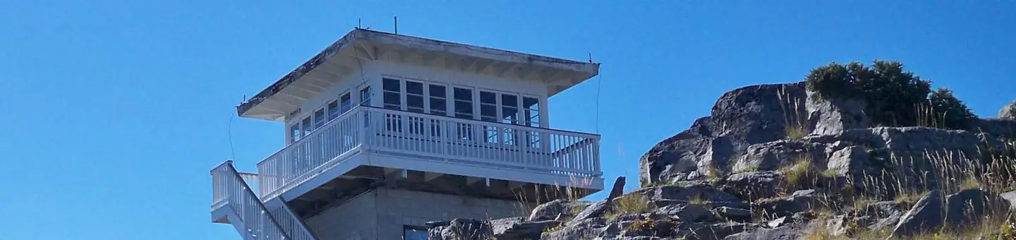
Cabin and lookout rentals nearby

On the National Register nearby
- Farmers and Merchants State BankBuilding · Eureka · 7.1 mi
- Eureka Community HallBuilding · Eureka · 7.2 mi
Guidebooks for Montana
We earn a small commission if you buy through these links. It does not change what we list.
Titles come from Open Library's catalog, matched by subject heading or by title.
Reference
Questions people ask
How much does it cost to camp at Camp 32?
$0.00 Pack in/Pack out
Source: Forest Service
How many sites does Camp 32 have?
8 sites.
Source: Forest Service
Can I bring an RV to Camp 32?
Camp 32 is listed for tents only.
Source: Forest Service
What if Camp 32 is full?
The nearest public campgrounds are Rexford Bench (4.8 mi, partly first-come), Tobacco River Campground (4.9 mi, first-come), and Peck Gulch Campground (9.2 mi, first-come).
Source: Campgrounds nearby