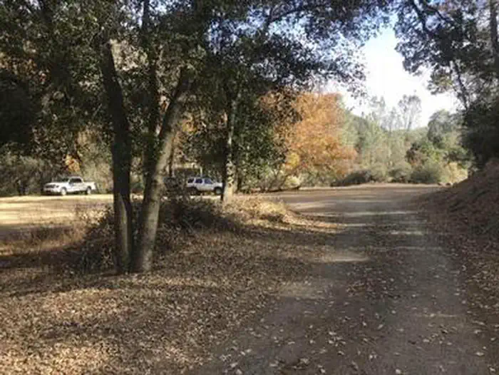
Colson Campground
Colson Campground closed permanently in April 2021. Please contact the Santa Lucia Ranger District for more information about the closure. The following campgrounds are open and can be accessed off Hwy 166: Bates Campground, Miranda Pine, Rock Front OHV Area (Buck Springs Campground, Paradise and Baja Campground), Horseshoe and Brookshire.
More like this: first-come in California · tent only in California

Amenities & rules
| Equipment | Tents |
Individual sites vary. Confirm on Recreation.gov or with the managing office.
Season & status
| Status | Closed for the season. Forest Service sites close for the season; check the official page for the reopening date. |
| Forest | Los Padres National Forest |
Weather by month
Getting there
| Coordinates | 34.9398° N, 120.1698° W · Directions ↗ |
Supplies & services
| Dump station | Flying Flags RV Resort ↗ | 22.7 mi |
| Outdoor gear | Surf Connection ↗ | 25.4 mi |
| RV sales & service | Harder RV Storage ↗ | 41.5 mi |
Locations © OpenStreetMap contributors. Call ahead; hours change seasonally.
Explore
Video
Colson group camp - Land Between the Lakes
Worth a stop
- 10.1 miAdobe Trailhead ↗Trailhead
- 12.8 miGifford Trailhead ↗Trailhead
Trails nearby
- 0.1 miBuckhorn Rigde1.8 mi trail · hiking, horse, bike
- 0.5 miAlejandro ↗5.5 mi trail · hiking, horse, bike
- 1.5 miBear Canyon Conn1.7 mi trail · hiking, horse, bike
- 2.2 miBear Canyon3.4 mi trail · hiking, horse, bike
- 4 miBear Canyon Loop OHV ↗6.4 mi trail · hiking, horse, bike, motorcycle and 1 more
- 4.1 miHorseshoe Springs Spur OHV0.8 mi trail · hiking, horse, bike, motorcycle and 1 more
Trail and trailhead records are the Forest Service's. Distances are straight-line to the nearer trail end. Trail conditions are not tracked here.
Public land it sits in
This campground sits inside Los Padres National Forest.
- inLos Padres National Forest ↗National Forest · Forest Service · 1,970,265 acres
- 9.6 miSan Rafael Wilderness ↗Wilderness · Forest Service · 191,104 acres
Each unit is published as a centre point and an acreage rather than a boundary, so this section stands it in for a circle of the same area. Whether a campground is inside, and how far it is from one it is outside, are both approximate.
Other campgrounds nearby



Historic landmarks nearby


Guidebooks for California
We earn a small commission if you buy through these links. It does not change what we list.
Titles come from Open Library's catalog, matched by subject heading or by title.
Reference
Questions people ask
Is Colson Campground open right now?
Closed for the season as of Oct 26, 2026.
Source: Forest Service status
Can I bring an RV to Colson Campground?
Colson Campground is listed for tents only.
Source: Forest Service
What if Colson Campground is full?
The nearest public campgrounds are Horseshoe Springs Campground (6.4 mi, first-come), Mt. Figueroa Campground (17.6 mi), and Nira Campground (17.6 mi).
Source: Campgrounds nearby