Beth Lake Campground
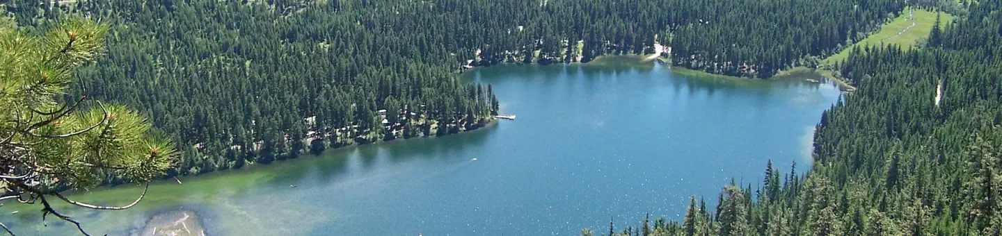
This campground has 15 sites in 2 small loops. There are boat launches on either end of the campground. The southern launch accesses Beaver Lake, while the northern launch accesses Beth Lake. An earthen dam is near the northern boat launch. The Beth Lake Trail #316 can be accessed near the earthen dam. There are 2 pit toilets, 2 double vault toilets, and 1 vault toilet. There is a garbage dumpster for campground users only. Water is available in the campground.
More like this: first-come in Washington · tent only in Washington

Amenities & rules
| Equipment | Tents |
| Fees | Camping: $10/single site. Extra Vehicle: $5/per night. No Water Available at this time |
Individual sites vary. Confirm on Recreation.gov or with the managing office.
Season & status
| Status | Closed for the season. Forest Service sites close for the season; check the official page for the reopening date. |
| Season | May 1 to October 27 |
| Forest | Colville National Forest |
| Fees | Camping: $10/single site. Extra Vehicle: $5/per night. No Water Available at this time |
| Rules | Washington state fishing license required. No wake zone for boating -8 mph maximum. Quiet hours between 10 p.m. and 6 a.m. Campfires in developed fire pits only. Fireworks are prohibited. Dogs must be on leash. OHV use prohibited in the campground. Maximum length of stay: 14 days. |
Weather by month
Getting there
| Coordinates | 48.8602° N, 118.9851° W · Directions ↗ |
Fire nearby
- PrescribedTon Rx - North Hull
13 mi from the campground · 332 acres
- PrescribedRep Rx - Walker 50
22 mi from the campground · 313 acres
- PrescribedRep Rx - Walker Hp
24 mi from the campground
- Prescribed3R Rx - Shed Mp
30 mi from the campground · 10 acres
Distance is to the reported incident point, not the fire edge. Call the managing office before you drive.
Supplies & services
| Dump station | Dump station ↗ | 17.7 mi |
| Outdoor gear | Wild Ways Adventure Sports ↗ | 37.5 mi |
| RV sales & service | RV sales & service ↗ | 38.2 mi |
Locations © OpenStreetMap contributors. Call ahead; hours change seasonally.
Explore
Video
Beth Page Campground Part 1, Crissy
Trails nearby
- 0.7 miBeth Lake1.9 mi trail · hiking, horse, bike
- 2.7 miStrawberry Mountain1.5 mi trail · hiking, horse, bike
- 2.7 miBig Tree ↗0.9 mi trail · hiking, horse, bike
- 3.8 miVirginia Lilly3.8 mi trail · hiking, horse, bike
Trail and trailhead records are the Forest Service's. Distances are straight-line to the nearer trail end. Trail conditions are not tracked here.
Public land it sits in
Colville National Forest begins about 8.8 miles away, and it is the closest of these.
- 8.8 miColville National Forest ↗National Forest · Forest Service · 1,752,994 acres
Each unit is published as a centre point and an acreage rather than a boundary, so this section stands it in for a circle of the same area. Whether a campground is inside, and how far it is from one it is outside, are both approximate.
Other campgrounds nearby



On the National Register nearby
- Lost Lake Guard StationBuilding · Tonasket · 3.1 mi
- Bonaparte Mountain CabinBuilding · Tonasket · 8.1 mi
- U.S. Inspection Station–Ferry, WashingtonBuilding · Curlew · 14 mi
Guidebooks for Washington
We earn a small commission if you buy through these links. It does not change what we list.
Titles come from Open Library's catalog, matched by subject heading or by title.
Reference
Questions people ask
Do I need a reservation at Beth Lake Campground?
No. Beth Lake Campground is first-come, first-served. Sites are taken on arrival and paid at the fee station.
Source: Forest Service
How much does it cost to camp at Beth Lake Campground?
Camping: $10/single site. Extra Vehicle: $5/per night. No Water Available at this time
Source: Forest Service
Is Beth Lake Campground open right now?
Closed for the season as of Oct 26, 2026. Season May 1 to October 27.
Source: Forest Service status
How many sites does Beth Lake Campground have?
15 sites.
Source: Forest Service
Can I bring an RV to Beth Lake Campground?
Beth Lake Campground is listed for tents only.
Source: Forest Service
What if Beth Lake Campground is full?
The nearest public campgrounds are Lost Lake Group Unit (3 mi), Bonaparte Lake Campground (5.7 mi, partly first-come), and Lambert Creek Horse Camp (22.9 mi, first-come).
Source: Campgrounds nearby