Skull Hollow Campground
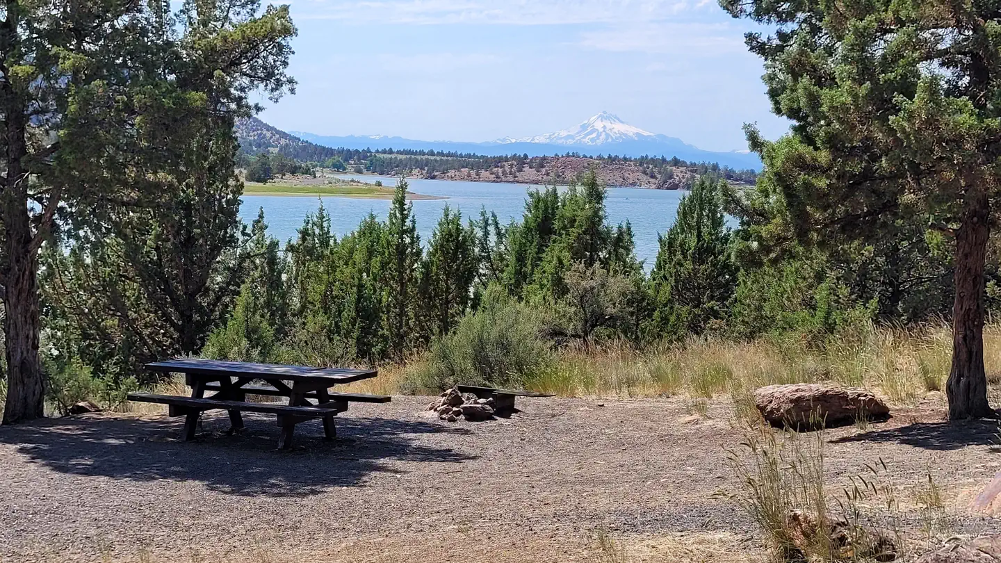
Situated southeast of Haystack Reservoir, this campground offers views of Gray Butte and easy access to Skull Hollow Trailhead, the Gray Butte Trailhead, the Cole Loop Trail (#854), and Smith Rock State Park. There is a Closure Order prohibiting dispersed camping outside of the Skull Hollow campground. This closure is designed to help protect natural resources around the trailhead from overuse and to prevent conflict between campers and day users. Please observe the closure order and use the campground for camping in the vicinity of Skull Hollow trailhead. AMENITIES. No drinking water.
More like this: first-come in Oregon · tent only in Oregon

Site map
6 campsite locations mapped by OpenStreetMap contributors. The site numbers are theirs and may not match the posts at the campground. Map data © OpenStreetMap contributors, ODbL.
Amenities & rules
| Equipment | Tents |
| Fees | Per night, per site fee: $15 single campsite/ $7 extra vehicle fee. $30 Double campsite. A single site allows 1 vehicle and 6 people. A double site allows 2 vehicles and 12 people. Any other vehicles more than 2 on a double site or more than 1 on a single site are subject to a $5 extra vehicle fee. |
Individual sites vary. Confirm on Recreation.gov or with the managing office.
Season & status
| Status | Open |
| Season | March 15 to November 15 (weather permitting) |
| Forest | Ochoco National Forest |
| Booking | This facility managed through as third party concessionaire under permit. The popularity of Skull Hollow is largely dependent on weather. |
| Fees | Per night, per site fee: $15 single campsite/ $7 extra vehicle fee. $30 Double campsite. A single site allows 1 vehicle and 6 people. A double site allows 2 vehicles and 12 people. Any other vehicles more than 2 on a double site or more than 1 on a single site are subject to a $5 extra vehicle fee. |
| Rules | There is a 14 day stay limit on all National Grassland and US Forest Service land including but not limited to campgrounds and other developed facilities. Additionally, the general area outside Skull Hollow campground is CLOSED to camping and fires within a ¼ mile of the road from the junction of FS 5710 and Lone Pine Road to the junction of County Roads 5710 and 5720. |
Weather by month
Getting there
| Coordinates | 44.3972° N, 121.0630° W · Directions ↗ |
Fire nearby
- WildfireBench
22 mi from the campground · 67,071 acres · 90% contained
- PrescribedMuddy Run Rx
33 mi from the campground · 152 acres
- PrescribedTule Rx
37 mi from the campground · 300 acres
- PrescribedTriple Butte Rx
46 mi from the campground
Distance is to the reported incident point, not the fire edge. Call the managing office before you drive.
Supplies & services
| Outdoor gear | Redpoint ↗ | 6.5 mi |
| RV sales & service | Big Country RV ↗ | 11.2 mi |
| Dump station | Dump station ↗ | 13.8 mi |
Locations © OpenStreetMap contributors. Call ahead; hours change seasonally.
Explore
Worth a stop
- 4.7 miTrail Crossing Corrals Trailhead ↗Trailhead
- 14.1 mi
Trails nearby
- 2.5 miGray Butte3.9 mi trail · hiking, horse, bike
- 4 miRidge Rider - Cole Loop ↗23.2 mi trail · hiking, horse, bike
- 4 miRidge Rider - Warner Loop ↗8.9 mi trail · hiking, horse, bike
- 4.3 miOHV # 280.6 mi trail · hiking, horse, bike, motorcycle and 2 more
- 4.4 miOHV # 380.3 mi trail · hiking, horse, bike, motorcycle and 2 more
- 4.6 miOHV # 360.4 mi trail · hiking, horse, bike, motorcycle and 2 more
Trailheads within three miles
- 0.1 miSkull Hollow Trailhead ↗Ochoco National Forest
- 2.6 miGray Butte Trailhead ↗Ochoco National Forest
Trail and trailhead records are the Forest Service's. Distances are straight-line to the nearer trail end. Trail conditions are not tracked here.
Public land it sits in
Ochoco National Forest begins about 10.8 miles away, and it is the closest of these.
- 10.8 miOchoco National Forest ↗National Forest · Forest Service · 912,775 acres
- 14.9 miDeschutes National Forest ↗National Forest · Forest Service · 1,870,116 acres
Each unit is published as a centre point and an acreage rather than a boundary, so this section stands it in for a circle of the same area. Whether a campground is inside, and how far it is from one it is outside, are both approximate.
Other campgrounds nearby



On the National Register nearby
- Pilot Butte Canal: Downtown Redmond Segment Historic DistrictHistoric district · Redmond · 9.3 mi
- First Presbyterian Church of RedmondBuilding · Redmond · 10.1 mi
- Norman and Frances Swanson HouseBuilding · Redmond · 10.1 mi
Guidebooks for Oregon
We earn a small commission if you buy through these links. It does not change what we list.
Titles come from Open Library's catalog, matched by subject heading or by title.
Reference
Questions people ask
How much does it cost to camp at Skull Hollow Campground?
Per night, per site fee: $15 single campsite/ $7 extra vehicle fee. $30 Double campsite. A single site allows 1 vehicle and 6 people.
Source: Forest Service
Is Skull Hollow Campground open right now?
Open as of Oct 26, 2026. Season March 15 to November 15 (weather permitting).
Source: Forest Service status
How many sites does Skull Hollow Campground have?
70 sites.
Source: Forest Service
Can I bring an RV to Skull Hollow Campground?
Skull Hollow Campground is listed for tents only.
Source: Forest Service
What if Skull Hollow Campground is full?
The nearest public campgrounds are Henderson Flat Staging Area (4.6 mi, first-come), Haystack Campground (East Shore) (7.8 mi), and South Shore Group Campground (7.8 mi, partly first-come).
Source: Campgrounds nearby