Rock Creek
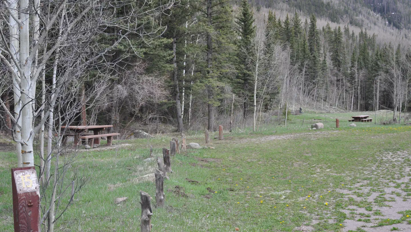
This campground and adjacent picnic area complex is located alongside the fast-moving Rock Creek in a stand of mature Aspen trees. There are 10 sites of which 7 are dead end spurs and 3 are pull through sites. The sound of the creek can be heard throughout the campground with some sites located next to the creek. This campground/picnic area sits in a narrow mountain valley and is located fairly close to the town of Monte Vista. Fishing in the North and South Forks of Rock Creek and hiking on area trails. Big game hunting in the forest in season.
More like this: reservable in Colorado · tent only in Colorado
Check availability on Recreation.gov ↗
Site mix
| Standard, no hookups | 11 |
Amenities & rules
| Equipment | Tents |
| Fees | Single site - $10/night Day use - $10/day (picnicking) Fee envelopes and a collection box are located near the entrance. |
Individual sites vary. Confirm on Recreation.gov or with the managing office.
Season & status
| Status | Open |
| Season | May 15th |
| Forest | Rio Grande National Forest |
| Booking | First come, first serve. |
| Fees | Single site - $10/night Day use - $10/day (picnicking) Fee envelopes and a collection box are located near the entrance. |
| Rules | No horses in campground sites. Must have a Colorado Fishing License to fish in Rock Creek. |
Weather by month
Getting there
In Monte Vista, CO, take State 15 south 2.4 miles to Rock Creek Campground sign. Turn right go 2.5 miles to a "T" intersection. Turn left onto County Rd. 28 and go 10 miles to campground sign. Turn left into campground. NOTE: County Rd. 28 is dirt after 3.1 miles and single-lane in places.
| Nearest town | Del Norte, Colorado |
| Coordinates | 37.4690° N, 106.3323° W · Directions ↗ |
Supplies & services
| RV sales & service | RV sales & service ↗ | 19.1 mi |
| Outdoor gear | Kristi's Mountain Sports ↗ | 23.6 mi |
| Dump station | Dump station ↗ | 33.7 mi |
Locations © OpenStreetMap contributors. Call ahead; hours change seasonally.
Explore
Video
⛺ Rock Creek Campground Review // Perry, KS // USACE
Worth a stop
- 0.3 mi
- 6 miAlamosa Trailhead And Trail 703 ↗Trailhead
- 7 miWest Frisco Trailhead #850 ↗Trailhead
- 11.6 miKerr Lake Fishing Site ↗Fishing site
Trails nearby
- 0.3 miNorth Rock ↗6.6 mi trail · hiking, horse, bike
- 2.3 miAlamosa Rock ↗5.4 mi trail · hiking, horse, bike, motorcycle and 1 more
- 2.3 miDry Creek ↗16 mi trail · hiking, horse, bike, motorcycle and 2 more
- 4.6 miSouth Rock1.9 mi trail · hiking, horse, bike, motorcycle and 2 more
- 4.7 miSilver Mtn ↗12.2 mi trail · hiking, horse, bike, motorcycle and 2 more
Trail and trailhead records are the Forest Service's. Distances are straight-line to the nearer trail end. Trail conditions are not tracked here.
Public land it sits in
This campground sits inside Rio Grande National Forest.
- inRio Grande National Forest ↗National Forest · Forest Service · 1,937,280 acres
- 10.8 miMonte Vista National Wildlife Refuge ↗National Wildlife Refuge · Fish and Wildlife Service · 16,250 acres
- 13.9 miSouth San Juan Wilderness ↗Wilderness · Forest Service · 160,997 acres
Each unit is published as a centre point and an acreage rather than a boundary, so this section stands it in for a circle of the same area. Whether a campground is inside, and how far it is from one it is outside, are both approximate.
Other campgrounds nearby


Cabin and lookout rentals nearby
On the National Register nearby
- Central School Auditorium and GymnasiumBuilding · Monte Vista · 12.6 mi
- First Methodist Episcopal ChurchBuilding · Monte Vista · 12.6 mi
- Monte Vista Downtown Historic DistrictHistoric district · Monte Vista · 12.7 mi
Guidebooks for Colorado
We earn a small commission if you buy through these links. It does not change what we list.
Titles come from Open Library's catalog, matched by subject heading or by title.
Reference
Questions people ask
Do I need a reservation at Rock Creek?
Sites at Rock Creek are reservable on Recreation.gov. First come, first serve. Any walk-up sites are listed on the booking page.
Source: Recreation.gov
How much does it cost to camp at Rock Creek?
Single site - $10/night Day use - $10/day (picnicking) Fee envelopes and a collection box are located near the entrance.
Source: Recreation.gov
Is Rock Creek open right now?
Open as of Oct 26, 2026. Season May 15th.
Source: Forest Service status
How many sites does Rock Creek have?
11 sites, including 11 standard sites without power.
Source: Recreation.gov
Can I bring an RV to Rock Creek?
Rock Creek is listed for tents only.
Source: Recreation.gov
What is the nearest town to Rock Creek?
Del Norte, Colorado.
Source: Getting there
What if Rock Creek is full?
The nearest public campgrounds are Comstock (2.3 mi, first-come), Alamosa Campground (6.2 mi, first-come), and Lake Fork(Rio Grande Natl Fore (13.8 mi).
Source: Campgrounds nearby